 This unspeakably beautiful country really needs photos to attempt to do the landscape justice. Iceland has everything you could possibly imagine- waterfalls, beaches, glaciers, hot springs, oceans, farms, sheep and reindeer, fjords, and mountains.
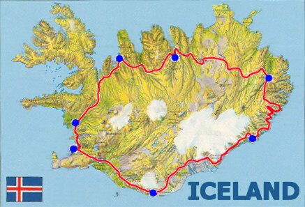
We rented a four-wheel drive vehicle and spent a week driving around this wonderful country on the infamous Ring Road, the 800+ mile route that connects the inhabited cities of Iceland.
The island is incredibly easy to navigate, locals are friendly, and just about everywhere is breathtaking. There are many different sites that recommend the best way to enjoy the Ring Road. Here’s the path we took:
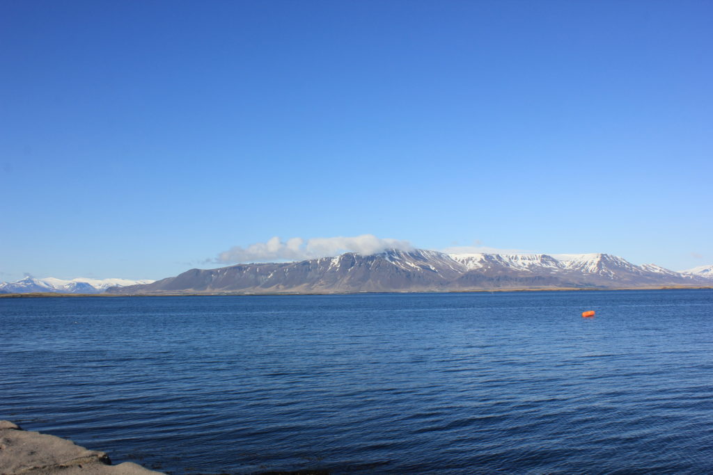
Day 1- Reykjjavik
Iceland’s capital and largest city is known for being clean, safe, and having an exciting weekend night life. We spent one night here and had a fantastic last dinner out downtown. Iceland is also known for being incredibly, incredibly expensive, so every meal afterwards was snacking.
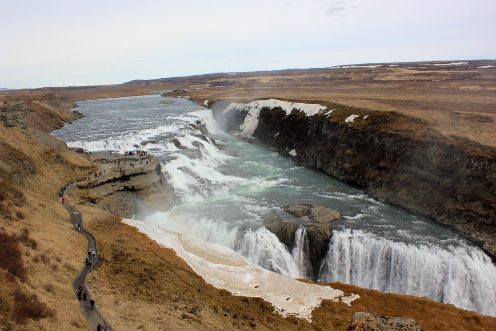
Day 2: Þingvellir, Gullfoss Waterfall, and Geysir
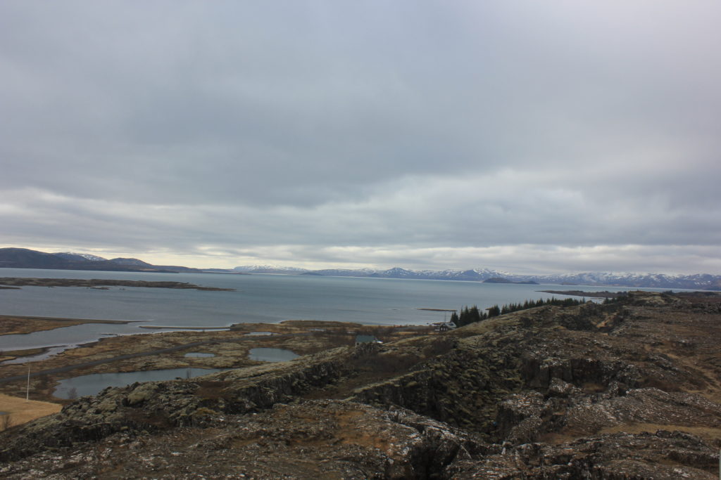
Our first stop was Þingvellir National Park, a short drive outside of Reykavik.
Our next stop was Gullfoss, one of Iceland’s most popular tourist destiantions.
We stayed at the Hotel Geysir, located directly across the street from Great Geysir and the hot spring field. This geyser has been active for over 10,000 years, and erupted multiple times during our stay. This hotel also had a free traditional Icelandic breakfast, including fish that had been cooked overnight in the geothermal steam.
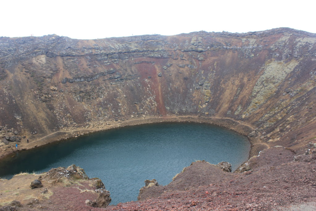
Day 3: Hveragerði, Kerid crater, and Seljalandsfoss
The town of Hveragerði is famous for being the hot spring capital of the world and is full of hiking trails through steam filled rolling hills. A quick stop at the volcanic Kerid Crater is worth
it to admire the sheer vastness. Seljalandsfoss is another of the country’s most famous sights and has a trail that goes behind the waterfall into a small cave. The stop is just off of route one.
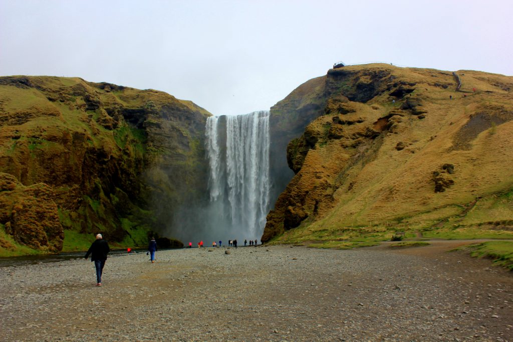
Day 4: Skógafoss and Vik
Skógafoss is located in South Iceland and has a stunning 200 foot drop. The southern seaside town of Vik is close to the Dyrhólaey peninsula and the black sand beaches of Reynisfjara.
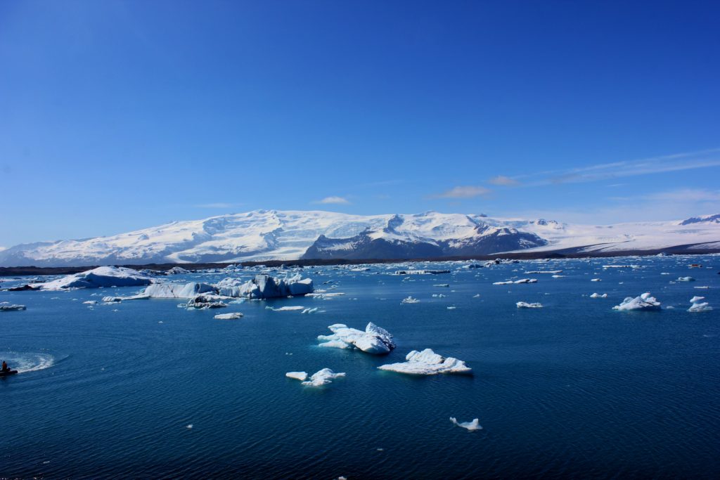
Day 5: Jökulsárlón Glacier Park
Glacial lake created by warming climates located in southeast Iceland. Constantly moving pieces of ice broken off from a nearby glacier float by in the impossibly blue water. The Visitors Center offers amphibian boat tours that take you around the lagoon.
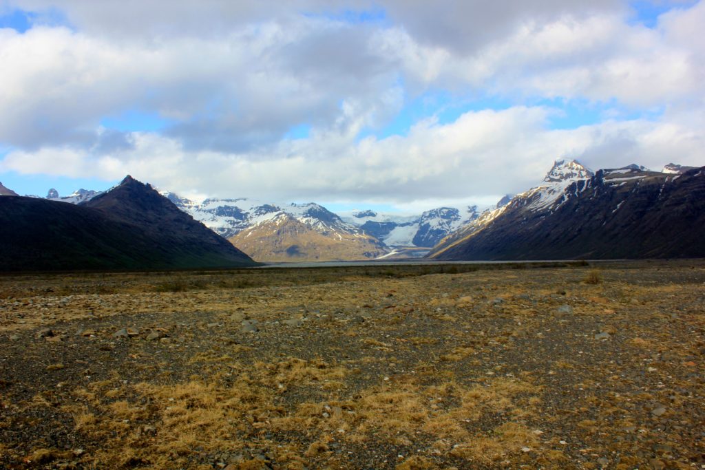
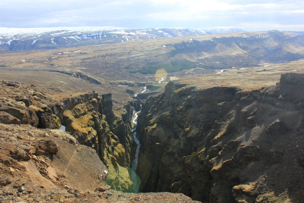
Day 6: Vatnajökull National Park
One of three national parks in Iceland, it covers almost 15% of the country and is the second largest national park in Europe.
We entered in the southern territory at the Skaftafell Visitor’s Center, where many easily marked hikes start. We hiked to Svartifoss, and along the path to the glacier Skaftafellsjökul. The park is so vast I could recommend several days exploring here.
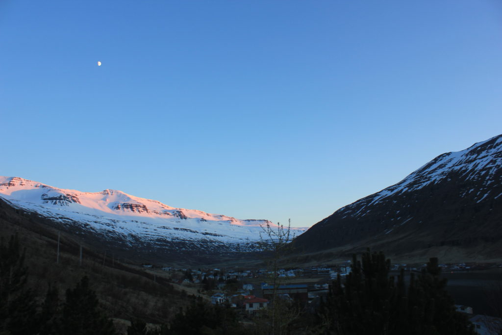
Day 7: Seyðisfjörður
Seyðisfjörður is a small coastal town in the north eastern area of Iceland, perfect for a quiet rest and hiking.This isn’t a typical Ring Road stop, but the drive through the East fjord mountains to get here was unbelievable.
We were the only guests at Nord Marina Guesthouse, which truly is located right on the marina. When we showed up the owner was standing on the dock with binoculars watching for whales.
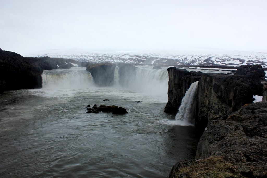
Day 8: Dettifoss and Godafoss
Dettifoss is the most powerful waterfall in Europe. I promise you will not get tired of visiting so many waterfalls in a week. And hour and a half down the road is Godafoss. The northern area of Iceland has breathtaking scenery (does it become cliche if you say breathtaking too much?) that absolutely that make long days on the road enjoyable.
Day 9: Glymur
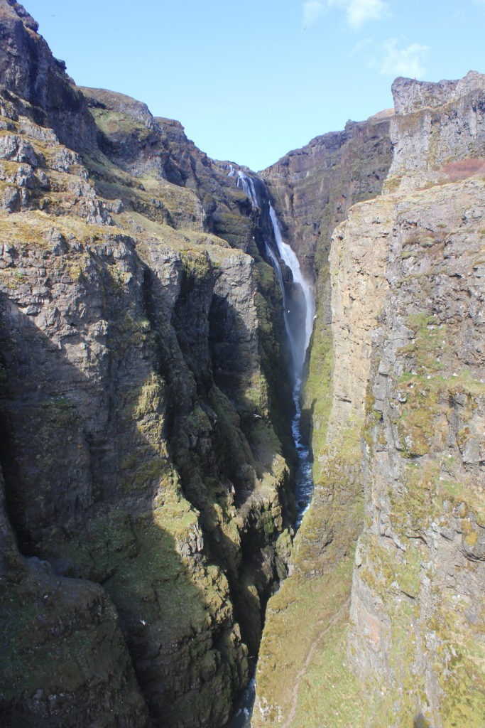
Our last stop before we completed our circle and returned to Reykjavik was Glymur, Iceland’s tallest waterfall. The waterfall itself is only reachable by hike. I’d suggest making sure you’re physically up for the challenge, since the path leads through a cave, very steep inclines, and a across a stream with a rope for balance. The views from the hike are almost as spectacular as the waterfall itself. If you want to hike down the opposite side of the waterfall, you’ll need to take your boots off and cross the fast moving stream that leads into the waterfall. There is no bridge, no rocks to stand on, and the water is absolutely freezing. I think my feet got an idea what it felt like during the sinking of Titanic.